Ukiah, Oregon | |
|---|---|
 Ukiah skyline | |
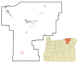
 Location in Oregon | |
| Coordinates: 45°08′04″N 118°55′59″W / 45.13444°N 118.93306°W | |
| Country | United States |
| State | Oregon |
| County | Umatilla |
| Incorporated | 1969 |
| Area | |
| • Total | 0.24 sq mi (0.62 km2) |
| • Land | 0.24 sq mi (0.62 km2) |
| • Water | 0.00 sq mi (0.00 km2) |
| Elevation | 3,356 ft (1,023 m) |
| Population | |
| • Total | 159 |
| • Density | 668.07/sq mi (257.67/km2) |
| Time zone | UTC-8 (Pacific) |
| • Summer (DST) | UTC-7 (Pacific) |
| ZIP code | 97880 |
| Area code | 541 |
| FIPS code | 41-75550[4] |
| GNIS feature ID | 2412126[2] |
| Website | www.cityofukiahoregon.com |
Ukiah (/juːkaɪʌ/) is a city in Umatilla County, Oregon, United States. The population was 186 at the 2010 census. It is part of the Hermiston-Pendleton Micropolitan Statistical Area. It was named by an early settler after the town of Ukiah, California.[5]
Ukiah is tied with Seneca, in Grant County, for the coldest official temperature in Oregon.[6] Ukiah dropped to −54 °F (−48 °C) on February 9, 1933, during a major cold snap across Siberia and North America.[7] On February 10, Seneca also hit −54 °F,[8] so the National Weather Service gives Seneca the record because it had the most recent occurrence of that temperature.[6][7]
- ^ "ArcGIS REST Services Directory". United States Census Bureau. Retrieved October 12, 2022.
- ^ a b U.S. Geological Survey Geographic Names Information System: Ukiah, Oregon
- ^ Cite error: The named reference
USCensusDecennial2020CenPopScriptOnlywas invoked but never defined (see the help page). - ^ Cite error: The named reference
wwwcensusgovwas invoked but never defined (see the help page). - ^ "Welcome to the City of Ukiah, Oregon". The City of Ukiah. Retrieved June 5, 2015.
- ^ a b "Oregon's Top 10 Weather Events of the 1900s". Western Regional Climate Center. Retrieved September 14, 2013.
- ^ a b "54 below zero, Seneca is Oregon's Icebox". Oregon Photos. July 3, 2013. Retrieved September 14, 2013.
This site also mentions Oregon's unofficial record low of −60 °F (−51 °C), recorded near Paulina Lake. - ^ "United States Extreme Record Temperatures & Differences". Golden Gate Weather Services. 2005. Retrieved September 14, 2013.
This site uses information from the National Climatic Data Center.