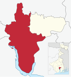
Uluberia Sub-Division
উলুবেড়িয়া মহকুমা | |
|---|---|
subdivision | |
 Map of Uluberia Subdivision | |
| Coordinates: 22°28′N 88°07′E / 22.47°N 88.11°E | |
| Country | |
| State | West Bengal |
| District | Howrah |
| Headquarters | Uluberia |
| Population (2011) | |
• Total | 2,038,685 |
| Languages | |
| • Official | Bengali, English |
| Time zone | UTC+5:30 (IST) |
| ISO 3166 code | ISO 3166-2:IN |
| Vehicle registration | WB |
| Website | wb |
Uluberia subdivision is a subdivision of the Howrah district in the state of West Bengal, India. It consists of Uluberia municipality and nine community development (CD) blocks, including 90 gram panchayats and six census towns.[1] The six census towns are: Khalor, Bagnan, Naupala, Santoshpur, Balaram Pota and Uttar Pirpur.[2] The subdivision has its headquarters at Uluberia. The whole division forms the Lok Sabha constituency of Uluberia.[3]
- ^ "Directory of District, Sub division, Panchayat Samiti/ Block and Gram Panchayats in West Bengal, March 2008". West Bengal. National Informatics Centre, India. 19 March 2008. Archived from the original on 25 February 2009. Retrieved 21 December 2008.
- ^ "District Wise List of Statutory Towns (Municipal Corporation, Municipality, Notified Area and Cantonment Board), Census Towns and Outgrowths, West Bengal, 2001". Census of India, Directorate of Census Operations, West Bengal. Archived from the original on 30 September 2007. Retrieved 21 December 2008.
- ^ "Press Note, Delimitation Commission" (PDF). Assembly Constituencies in West Bengal. Delimitation Commission. pp. 15, 24. Retrieved 18 January 2009.

