Ulvenhout | |
|---|---|
Village | |
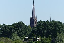
 St Laurentius Church | |
| Coordinates: 51°33′N 4°48′E / 51.550°N 4.800°E | |
| Country | Netherlands |
| Province | North Brabant |
| Municipality | Breda Alphen-Chaam |
| Area | |
• Total | 12.45 km2 (4.81 sq mi) |
| Elevation | 5 m (16 ft) |
| Population (2021)[1] | |
• Total | 5,220 |
| • Density | 420/km2 (1,100/sq mi) |
| Time zone | UTC+1 (CET) |
| • Summer (DST) | UTC+2 (CEST) |
| Postal code | 4851 & 4858[1] |
| Dialing code | 076 |
Ulvenhout is a village in the Dutch province of North Brabant. It is located in the municipality of Breda. The village was divided by the A58 motorway. The southern part belongs to the municipality of Alphen-Chaam and is called Ulvenhout AC.
- ^ a b c "Kerncijfers wijken en buurten 2021". Central Bureau of Statistics. Retrieved 14 April 2022.
two entries
- ^ "Postcodetool for 4851AA". Actueel Hoogtebestand Nederland (in Dutch). Het Waterschapshuis. Retrieved 14 April 2022.


