| Umatilla National Forest | |
|---|---|
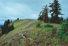
 Oregon Butte in the Wenaha–Tucannon Wilderness, Umatilla NF | |
| Location | Oregon / Washington, United States |
| Nearest city | Elgin, Oregon |
| Coordinates | 45°38′00″N 118°11′00″W / 45.63333°N 118.18333°W |
| Area | 1,407,087 acres (5,694 km2)[1] |
| Established | July 1, 1908[2] |
| Visitors | 703,000[3] (in 2006) |
| Governing body | U.S. Forest Service |
| Website | Umatilla National Forest |
The Umatilla National Forest, in the Blue Mountains of northeast Oregon and southeast Washington, covers an area of 1.4 million acres (5,700 km2). In descending order of land area the forest is located in parts of Umatilla, Grant, Columbia, Morrow, Wallowa, Union, Garfield, Asotin, Wheeler, and Walla Walla counties. (Columbia, Garfield, Asotin, and Walla Walla counties are in Washington, while the rest are in Oregon.) More than three-quarters of the forest lies in the state of Oregon.[4] Forest headquarters are located in Pendleton, Oregon. There are local ranger district offices in Heppner and Ukiah in Oregon, and in Pomeroy and Walla Walla in Washington.[5]
- ^ "Land Areas of the National Forest System" (PDF). U.S. Forest Service. January 2012. Retrieved June 30, 2012.
- ^ "The National Forests of the United States" (PDF). ForestHistory.org. Retrieved July 30, 2012.
- ^ Revised Visitation Estimates - National Forest Service
- ^ Table 6 - NFS Acreage by State, Congressional District and County - United States Forest Service - September 30, 2007
- ^ "USFS Ranger Districts by State" (PDF). ufwda.org. Retrieved 14 June 2017.
