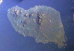
 Space Shuttle image of Umboi Island (north to upper right) | |
 Umboi Island is to the west of New Britain | |
| Geography | |
|---|---|
| Coordinates | 5°32′S 147°52′E / 5.533°S 147.867°E |
| Archipelago | Bismarck Archipelago |
| Area | 930 km2 (360 sq mi) |
| Highest elevation | 1,335 m (4380 ft) |
| Highest point | Mount Talo |
| Administration | |
Papua New Guinea | |
| Province | Morobe Province |
| LLG | Siassi Rural LLG |
Umboi (also named Rooke or Siassi) is a volcanic island between the mainland of Papua New Guinea and the island of New Britain. It is separated from New Britain by the Dampier Strait, and Huon Peninsula and New Guinea by the Vitiaz Strait. It has an elevation of 1,335 metres (4,380 feet).
The Siassi Archipelago lies off the southeast coast of Umboi Island (a total of 18 islands, only seven are inhabited).