This article needs additional citations for verification. (September 2009) |
Unalakleet
| |
|---|---|
 Aerial view of Unalakleet, taken 2010 | |
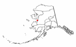
 Location of Unalakleet, Alaska | |
| Coordinates: 63°52′44″N 160°47′23″W / 63.87889°N 160.78972°W | |
| Country | United States |
| State | Alaska |
| Census Area | Nome |
| Incorporated | 1974[1] |
| Government | |
| • Mayor | Abel Razzo |
| • State senator | Donny Olson (D) |
| • State rep. | Neal Foster (D) |
| Area | |
| • Total | 4.95 sq mi (12.81 km2) |
| • Land | 2.86 sq mi (7.41 km2) |
| • Water | 2.08 sq mi (5.40 km2) |
| Elevation | 7 ft (2 m) |
| Population (2020) | |
| • Total | 765 |
| • Density | 267.30/sq mi (103.20/km2) |
| Time zone | UTC-9 (Alaska (AKST)) |
| • Summer (DST) | UTC-8 (AKDT) |
| ZIP code | 99684 |
| Area code | 907 |
| FIPS code | 02-80660 |
| GNIS feature ID | 1411517 |
Unalakleet (/ˈjuːnələkliːt/ YOO-nə-lə-kleet; Inupiaq: Uŋalaqłiq, IPA: [uŋɐlɑχɬeq] or Uŋalaqłiit; Yup'ik: Ungalaqliit; Koyukon: Kk'aadoleetno’) is a city in Nome Census Area, Alaska, United States, in the western part of the state. At the 2010 census the population was 765, up from 688 in 2000. Unalakleet is known in the region and around Alaska for its salmon and king crab harvests; the residents rely for much of their diet on caribou, ptarmigan, oogruk (bearded seal), and various salmon species.
Unalakleet is also known for its aesthetic value. It is located next to the Bering Sea and the large, clean Unalakleet River. The landscape also has trees, tundra, and hills behind it.
- ^ 1996 Alaska Municipal Officials Directory. Juneau: Alaska Municipal League/Alaska Department of Community and Regional Affairs. January 1996. p. 153.
- ^ "2020 U.S. Gazetteer Files". United States Census Bureau. Retrieved October 29, 2021.