This article needs additional citations for verification. (September 2013) |
Native name: Péninsule d'Ungava ᐅᖓᕙ | |
|---|---|
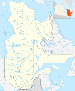
 Location of the Ungava Peninsula | |
| Geography | |
| Location | Nunavik, Quebec |
| Coordinates | 60°24′19″N 73°57′34″W / 60.40528°N 73.95944°W[1] |
| Adjacent to | Arctic Ocean |
| Area | 252,000 km2 (97,000 sq mi) |
| Administration | |
Canada | |
| Demographics | |
| Population | 12,000 |
| Ethnic groups | Inuit |
The Ungava Peninsula, officially Péninsule d'Ungava,[1] is the far northwestern part of the Labrador Peninsula of the province of Quebec, Canada. Bounded by Hudson Bay to the west, Hudson Strait to the north, and Ungava Bay to the east, it covers about 252,000 km2 (97,000 sq mi). Its northernmost point is Cape Wolstenholme, which is also the northernmost point of Quebec. The peninsula is also part of the Canadian Shield, and consists entirely of treeless tundra dissected by large numbers of rivers and glacial lakes, flowing generally east–west in a parallel fashion. The peninsula was not deglaciated until 6,500 years ago (11,500 years after the Last Glacial Maximum) and is believed to have been the prehistoric centre from which the vast Laurentide Ice Sheet spread over most of North America during the last glacial epoch.
The Unavuk Peninsula is part of the Nunavik proposed autonomous area of Quebec.
