Union County | |
|---|---|
 Union County Courthouse | |
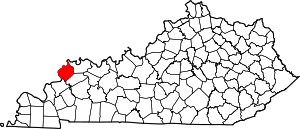
 Location within the U.S. state of Kentucky | |
 Kentucky's location within the U.S. | |
| Coordinates: 37°40′N 87°57′W / 37.66°N 87.95°W | |
| Country | |
| State | |
| Founded | January 15, 1811 |
| Seat | Morganfield |
| Largest city | Morganfield |
| Area | |
• Total | 363.38 sq mi (941.1 km2) |
| • Land | 342.85 sq mi (888.0 km2) |
| • Water | 20.53 sq mi (53.2 km2) 5.6% |
| Population (2020) | |
• Total | 13,668 |
• Estimate (2023) | 13,106 |
| • Density | 38/sq mi (15/km2) |
| Time zone | UTC−6 (Central) |
| • Summer (DST) | UTC−5 (CDT) |
| Congressional district | 1st |
| Website | www |
Union County is a county in the U.S. state of Kentucky. As of the 2020 census, the population was 13,668.[1] Its county seat is Morganfield.[2] The county was created effective January 15, 1811.
The county is located on the east bank of the Ohio River opposite its confluence with the Wabash River. Union County, along with neighboring Posey County, Indiana, and Gallatin County, Illinois, form the tri-point of the Illinois-Indiana-Kentucky Tri-State Area.
- ^ "State & County QuickFacts". United States Census Bureau. Retrieved March 24, 2023.
- ^ "Find a County". National Association of Counties. Retrieved June 7, 2011.