Stormont, Dundas and Glengarry | |
|---|---|
| United Counties of Stormont, Dundas and Glengarry | |
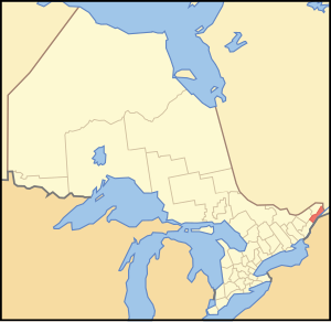
 Location of Stormont Dundas and Glengarry United Counties | |
| Coordinates: 45°10′N 74°57′W / 45.167°N 74.950°W | |
| Country | Canada |
| Province | Ontario |
| Region | Eastern Ontario |
| Established | 1850 |
| County seat | Cornwall |
| Municipalities | |
| Government | |
| • Warden | Tony Fraser |
| Area | |
| • Land | 3,309.87 km2 (1,277.95 sq mi) |
| Population (2016)[2] | |
| • Total | 113,429 |
| • Density | 34.3/km2 (89/sq mi) |
| Time zone | UTC-5 (EST) |
| • Summer (DST) | UTC-4 (EDT) |
| Website | www.sdg.on.ca |
The United Counties of Stormont, Dundas and Glengarry (SDG) is an upper-tier municipality in the Canadian province of Ontario that comprises three historical counties and excludes the City of Cornwall and the Mohawk Nation of Akwesasne. However, both Cornwall and Akwesasne form part of a larger census division named for the United Counties of Stormont, Dundas and Glengarry. The municipality's administrative office is located within Cornwall.
The United Counties of SDG borders Quebec to the east and New York in the United States to the south. The sovereign Mohawk Nation of Akwesasne straddles both borders, thus including territory partly within Ontario, Quebec and New York.
- ^ "Stormont, Dundas and Glengarry United counties census profile". 2011 Census of Population. Statistics Canada. Retrieved 2012-03-21.
- ^ "Census Profile, 2016 Census Stormont, Dundas and Glengarry, United counties [Census division]". Statistics Canada. Retrieved June 3, 2019.