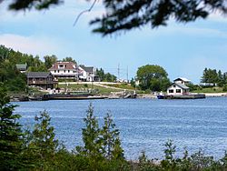
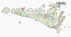
Unorganized West Manitoulin District | |
|---|---|
| Manitoulin, Unorganized, West Part | |
 Meldrum Bay | |
| Coordinates: 45°52′N 83°00′W / 45.867°N 83.000°W | |
| Country | |
| Province | |
| District | Manitoulin |
| Government | |
| • Federal riding | Algoma—Manitoulin—Kapuskasing |
| • Prov. riding | Algoma—Manitoulin |
| Area | |
| • Land | 407.54 km2 (157.35 sq mi) |
| Population (2016)[1] | |
• Total | 169 |
| • Density | 0.4/km2 (1/sq mi) |
| Time zone | UTC-5 (EST) |
| • Summer (DST) | UTC-4 (EDT) |
| Postal Code | P0P 1R0, P0P 1Y0 |
| Area code | 705 |

Unorganized West Part Manitoulin District is an unorganized area in Manitoulin District in northeastern Ontario, Canada, encompassing the portion of Manitoulin Island which is not part of an organized municipality.[2] It comprises the geographic townships of Robinson[3] and Dawson.[4]
Separate local services boards provide services in Robinson and Dawson townships.[5]
- ^ a b Cite error: The named reference
cp2011was invoked but never defined (see the help page). - ^ GeoSearch 2006
- ^ "Robinson". Geographical Names Data Base. Natural Resources Canada. Retrieved 2011-07-21.
- ^ "Dawson". Geographical Names Data Base. Natural Resources Canada. Retrieved 2011-07-21.
- ^ Local Services Boards, R.R.O. 1990, Reg. 737. Canadian Legal Information Institute.

