| Upper Angara Range Верхнеангарский хребет | |
|---|---|
 View of the range above the Upper Angara River. | |
| Highest point | |
| Peak | Unnamed |
| Elevation | 2,641 m (8,665 ft) |
| Coordinates | 56°21′23″N 111°38′48″E / 56.35639°N 111.64667°E |
| Dimensions | |
| Length | 200 km (120 mi) NE-SW |
| Width | 40 km (25 mi) |
| Geography | |
| Country | Russia |
| Federal subject | Buryatia / Irkutsk Oblast |
| Range coordinates | 56°20′N 111°30′E / 56.333°N 111.500°E |
| Parent range | North Baikal Highlands South Siberian System |
| Geology | |
| Rock type | Crystalline rocks with granite intrusions |
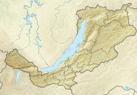
The Upper Angara Range (Russian: Верхнеангарский хребет) is a mountain range in Buryatia and Irkutsk Oblast, Russia, part of the Stanovoy Highlands.[1]
The Baikal–Amur Mainline passes at the foot of the southern side of the range.
