Upper Nazareth Township | |
|---|---|
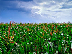
 Cornfield in Upper Nazareth Township in July 2012 | |
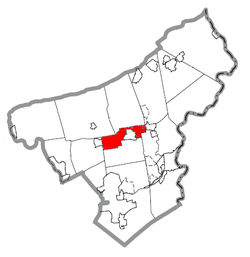
 Location of Upper Nazareth Township in Northampton County, Pennsylvania | |
 Location of Pennsylvania in the United States | |
| Coordinates: 40°43′30″N 75°22′30″W / 40.72500°N 75.37500°W | |
| Country | |
| State | |
| County | Northampton |
| Area | |
• City | 7.45 sq mi (19.30 km2) |
| • Land | 7.30 sq mi (18.92 km2) |
| • Water | 0.15 sq mi (0.38 km2) |
| Elevation | 413 ft (126 m) |
| Population (2010) | |
• City | 6,231 |
• Estimate (2016)[2] | 6,795 |
| • Density | 930.31/sq mi (359.21/km2) |
| • Metro | 865,310 (US: 68th) |
| Time zone | UTC-5 (EST) |
| • Summer (DST) | UTC-4 (EDT) |
| Area code(s) | 610 |
| FIPS code | 42-095-79192 |
| Primary airport | Lehigh Valley International Airport |
| Major hospital | Lehigh Valley Hospital–Cedar Crest |
| School district | Nazareth Area |
| Website | www |
Upper Nazareth Township is a township in Northampton County, Pennsylvania, United States. It is part of the Lehigh Valley metropolitan area, which had a population of 861,899 and was the 68th-most populous metropolitan area in the U.S. as of the 2020 census.[3] At the 2010 census, Upper Nazareth Township's population was 6,231.[4]
The township spans from the Stockertown Borough western border, wrapping most of the way Nazareth westward toward Bath. Most of the township's population is centered in the part of the township that lies northeast of Nazareth, an area and census designated place commonly referred to as East Lawn, or East Lawn Gardens.
Pennsylvania Route 191 runs through Upper Nazareth Township. Schoeneck, an Upper Nazareth Township village, is located in the township north of Nazareth and Nazareth Borough Park.
- ^ "2016 U.S. Gazetteer Files". United States Census Bureau. Retrieved August 14, 2017.
- ^ "Population and Housing Unit Estimates". Retrieved June 9, 2017.
- ^ "Upper Nazareth Township". Lehigh Valley Chamber of Commerce. Retrieved November 1, 2021.
- ^ "Table DP-1. Profile of General Demographic Characteristics: 2000 Geographic area: Upper Nazareth township, Northampton County, Pennsylvania" (PDF). pasdc.hbg.psu.edu.