| Vaartse Rijn | |
|---|---|
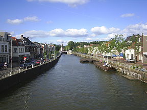
 The Vaartse Rijn in Utrecht, looking in the direction of the city centre | |
 | |
| History | |
| Date of first use | 1127 |
| Geography | |
| Start point | Utrecht 52°04′52″N 5°07′26″E / 52.0811°N 5.1238°E |
| End point | Lek, near Vreeswijk 52°00′10″N 5°05′30″E / 52.0029°N 5.0918°E |
The Vaartse Rijn is a canal connecting the city of Utrecht with Nieuwegein and the Lek river in the Dutch province of Utrecht. The Vaartse Rijn was formerly a major shipping route between Utrecht and the Rhine basin.