This article needs additional citations for verification. (November 2019) |
| Vajont Dam | |
|---|---|
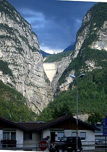
 Vajont Dam in 2002 | |
| Official name | Italian: Diga del Vajont |
| Location | Italy |
| Coordinates | 46°16′02″N 12°19′44″E / 46.26722°N 12.32889°E |
| Construction began | 1956[1] |
| Designed by | Carlo Semenza |
| Owner(s) | ENEL |
| Operator(s) | SADE – Società Adriatica di Elettricità (today part of Edison) |
| Dam and spillways | |
| Type of dam | Concrete double curvature arch dam |
| Impounds | Vajont River |
| Height | 262 metres (860 ft) |
| Length | 160 metres (520 ft) (chord)[1] |
| Width (crest) | 3.40 metres (11.2 ft).[2] |
| Width (base) | 27 metres (89 ft) |
| Reservoir | |
| Creates | Lago del Vajont |
| Total capacity | 168,715 thousand cubic metres (5,958,100×103 cu ft) |
| Power Station | |
| Turbines | 4[3] |

The Vajont Dam or Vaiont Dam is a disused hydro-electric dam in northern Italy. It is one of the tallest dams in the world, with a height of 262 m (860 ft).[5][6] It is in the valley of the Vajont (river) under Monte Toc, in the municipality of Erto e Casso, 100 km (62 mi) north of Venice.
The dam was conceived in the 1920s and eventually built between 1957 and 1960 by Società Adriatica di Elettricità, at the time the electricity supply and distribution monopoly in northeastern Italy. The engineer was Carlo Semenza (1893–1961). In 1962, the dam was nationalized and came under the control of ENEL as part of the Italian Ministry of Public Works.
On 9 October 1963, during initial filling of the lake, a landslide caused a megatsunami in which 50,000,000 m3 (1.8×10⁹ cu ft) of water overtopped the dam in a wave of 250 m (820 ft), bringing massive flooding and destruction to the Piave Valley below, destroying several villages and towns, causing an estimated 1,900 to 2,500 deaths.[1] The dam itself remained almost intact and two-thirds of the water was retained behind it.
This event occurred after ENEL and the Italian government concealed reports and dismissed evidence that Monte Toc, on the southern side of the lake, was geologically unstable. They had disregarded numerous warnings, danger signals, and negative appraisals. Underestimating the size of the landslide, ENEL's attempt to safely mitigate any landslide by lowering the level of the lake came too late, when disaster was almost imminent.[citation needed]
- ^ a b c d Petley, Dave (11 December 2008). "The Vaiont (Vajont) landslide of 1963". The Landslide Blog. Archived from the original on 14 January 2016. Retrieved 5 December 2019.
- ^ "The Malpasset Dam Disaster – could the Var suffer again? – Riviera Reporter". www.rivierareporter.com. Archived from the original on 26 January 2021. Retrieved 23 April 2018.
- ^ Cite error: The named reference
natgeotvwas invoked but never defined (see the help page). - ^ Cite error: The named reference
Vaj2was invoked but never defined (see the help page). - ^ "Vaiont Dam photos and virtual field trip". University of Wisconsin. Archived from the original on 14 May 2008. Retrieved 1 July 2009.
- ^ "Capolavoro d'ingegneria nel posto sbagliato". La Repubblica. Archived from the original on 26 October 2020. Retrieved 19 September 2014.
