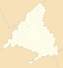
Valdemoro | |
|---|---|
 | |
| Coordinates: 40°11′27″N 3°40′27″W / 40.19083°N 3.67417°W | |
| Country | |
| Autonomous community | |
| Province | Madrid |
| Comarca | La Sagra |
| Judicial district | Valdemoro |
| Founded | See text |
| Government | |
| • Mayor | Sergio Parra (2019) |
| Area | |
• Total | 64.2 km2 (24.8 sq mi) |
| Elevation | 615 m (2,018 ft) |
| Highest elevation | 712 m (2,336 ft) |
| Lowest elevation | 560 m (1,840 ft) |
| Population (2018)[1] | |
• Total | 74,745 |
| • Density | 1,200/km2 (3,000/sq mi) |
| Demonym | Valdemoreños |
| Time zone | UTC+1 (CET) |
| • Summer (DST) | UTC+2 (CEST) |
| Postal code | 28340–28343 |
| Dialing code | 91 |
| Official language(s) | Spanish |
| Website | Official website |
Valdemoro is a municipal district, located in the Southern zone of the autonomous community of Madrid, Spain. Located 27 kilometers from the capital, Valdemoro is officially part of the comarca of La Sagra, though it is generally also included in the Madrid metropolitan area.
The municipality has experienced strong population growth in the past fifteen years, eventually reaching 74,745 inhabitants (INE 2018).[2] Valdemoro's proximity to the capital has favored the demographic and economic development of the area. Due to the recent population boom, Valdemoro has had to construct new transportation, educational, sanitation, health, and entertainment facilities.
The municipality's recent history is closely linked to that of the Guardia Civil. Valdemoro is home to the Colegio de Guardias Jóvenes Duque de Ahumada, an academy open only to children and orphans of existing guardsmen.
- ^ Municipal Register of Spain 2018. National Statistics Institute.
- ^ "Instituto nacional de Estadística" (in Spanish). Population statistics through 1 January 2006. Royal Decree 1627/2006, 29 December 2006


