Valjevo
Ваљево (Serbian) | |
|---|---|
| City of Valjevo | |
|
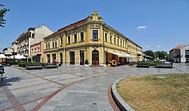
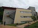
From top: City Center, Valjevo Gymnasium, Temple of Our Lord's Resurrection, Petnica Science Center, Court building, Sports hall, Tešnjar- old urban settlement | |
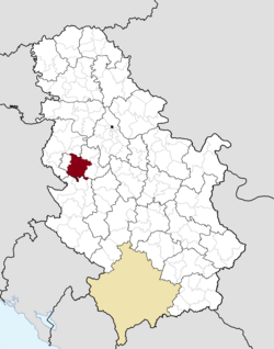
 Location of the city of Valjevo within Serbia | |
| Coordinates: 44°16′N 19°53′E / 44.267°N 19.883°E | |
| Country | |
| Region | Šumadija and Western Serbia |
| District | Kolubara |
| Settlements | 77 |
| Government | |
| • Mayor | Lazar Gojković (Serbian Progressive Party) |
| Area | |
| • Rank | 17th in Serbia |
| • Urban | 27.44 km2 (10.59 sq mi) |
| • Administrative | 905 km2 (349 sq mi) |
| Elevation | 199 m (653 ft) |
| Population (2022 census)[2] | |
| • Rank | 15th in Serbia |
| • Urban | 56,145 |
| • Urban density | 2,000/km2 (5,300/sq mi) |
| • Administrative | 82,169 |
| • Administrative density | 91/km2 (240/sq mi) |
| Time zone | UTC+1 (CET) |
| • Summer (DST) | UTC+2 (CEST) |
| Postal code | 14000 |
| Area code | +381(0)14 |
| ISO 3166 code | SRB |
| Car plates | VA |
| Website | www |
Valjevo (Serbian Cyrillic: Ваљево, pronounced [ʋâːʎeʋo]) is a city and the administrative center of the Kolubara District in western Serbia. According to the 2022 census, the administrative area of Valjevo had 82,169 inhabitants, 56,145 of whom were urban dwellers.
Valjevo occupies an area of 905 square kilometers; its altitude is 185 meters. The city is situated along the river Kolubara, a tributary of the Sava river.
- ^ "Municipalities of Serbia, 2006". Statistical Office of Serbia. Retrieved 2010-11-28.
- ^ "2011 Census of Population, Households and Dwellings in the Republic of Serbia: Comparative Overview of the Number of Population in 1948, 1953, 1961, 1971, 1981, 1991, 2002 and 2011, Data by settlements" (PDF). Statistical Office of Republic Of Serbia, Belgrade. 2014. ISBN 978-86-6161-109-4. Retrieved 2014-06-27.


