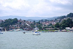
Valle de Bravo, State of Mexico | |
|---|---|
Municipality | |
 Panorama of the town from the lake | |
| Coordinates: 19°11′33″N 100°07′50″W / 19.19250°N 100.13056°W | |
| Country | |
| State | |
| Municipal Seat | Valle de Bravo |
| Town Founded | 1530 |
| Government | |
| • Municipal President | Michelle Núñez Ponce (2022–2024) |
| Elevation | 1,850 m (6,070 ft) |
| Population (2020) | |
• Total | 61,590 |
| • Demonym | Vallesano |
| Time zone | UTC-6 (Central Standard Time) |
| Postal code | 51200[1] |
Valle de Bravo (Latin American Spanish: [ˈbaʝe ðe ˈβɾaβo] ) is one of 125 municipalities in the State of Mexico, Mexico. The largest town and municipal seat is the town of Valle de Bravo. It is located on the shore of Lake Avándaro, approximately 156 km (97 miles) southwest of Mexico City and west of Toluca on highways 15, 134 or 1.[2] It takes about two hours to drive from Mexico City to Valle de Bravo, making it a popular weekend getaway for the capital's affluent upper class.
The town has several names during its history including San Francisco del Valle de Temascaltepec, Temascaltepec de indios, Villa del Valle, and San Francisco del Valle. The original names including Temascaltepec caused confusion with the nearby "Real de Minas de Temascaltepec", now Temascaltepec, so the county was known as "El Valle" (The Valley).[3] The honorific "de Bravo" was added later to recognize Nicolás Bravo who fought at the Castle of Chapultepec during the Mexican–American War. Its Coat of arms includes the image of a temazcal in reference to its original name.[4]
In 1971, Valle de Bravo was known as typical city (ciudad típica) and magical town (pueblo mágico) in 2005. The town and the surrounding area are well known in Mexico as a tourist destination, mainly due to its relative proximity to Mexico City and for having hosted the world-famous Circuito Avandaro auto racing event and Festival de rock y Ruedas, a massive rock music festival.[5]
- ^ https://www.worldpostalcodes.org/es/mexico/codigo-postal/51200
- ^ Estebanez(ed), Francisco; Jorge Arturo Gonzalez (2002). The State of Mexico. Mexico City: Ediciones Nueva Guia. ISBN 968-5437-26-2.
{{cite book}}:|last=has generic name (help) - ^ González Carranza, Héctor. Valle de Bravo (in Spanish). Toluca México. pp. 13–18. ISBN 968-484-420-4.
- ^ "Enciclopedia de los Municipios de Mexico Estado de Mexico Valle de Bravo". Archived from the original on 30 September 2007. Retrieved 10 April 2008.
- ^ Hernandez, Ricardo (10 September 2011). "Avándaro, a 40 años de distancia". El Mexicano. Retrieved 26 June 2014.

