Van Buren, Maine | |
|---|---|
 Van Buren's view from the Canada–US border | |
| Nickname: Gateway to the St. John Valley | |
| Motto(s): | |
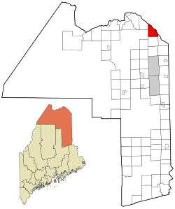
 Location of Van Buren, Maine | |
| Coordinates: 47°09′53″N 67°56′27″W / 47.16472°N 67.94083°W | |
| Country | United States |
| State | Maine |
| County | Aroostook |
| Incorporated (town) | March 1881 |
| Villages | Van Buren Keegan |
| Area | |
• Total | 34.86 sq mi (90.29 km2) |
| • Land | 33.78 sq mi (87.49 km2) |
| • Water | 1.08 sq mi (2.80 km2) |
| Population (2020) | |
• Total | 2,038 |
| • Density | 60/sq mi (23.3/km2) |
| Time zone | UTC-5 (Eastern (EST)) |
| • Summer (DST) | UTC-4 (EDT) |
| ZIP code | 04785 |
| Area code | 207 |
| Website | vanburenmaine |
Van Buren is a town on the Saint John River in Aroostook County, Maine, United States; located across from Saint-Leonard, New Brunswick, Canada. The population was 2,038 at the 2020 census.[2] It is named after U.S. President Martin Van Buren.[3]
- ^ Cite error: The named reference
Gazetteer fileswas invoked but never defined (see the help page). - ^ "Census - Geography Profile: Van Buren town, Aroostook County, Maine". Retrieved January 17, 2022.
- ^ Maine League of Historical Societies and Museums (1970). Doris A. Isaacson (ed.). Maine: A Guide 'Down East'. Rockland, Me: Courier-Gazette, Inc. p. 296.
