Van Hook, North Dakota | |
|---|---|
former Ghost town currently a thriving resort town | |
 Van Hook Arm (satellite image) | |
 | |
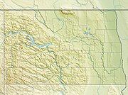
| Coordinates: 47°56′42″N 102°21′36″W / 47.945°N 102.36°W | |
| Country | United States |
| State | North Dakota |
| County | Mountrail |
| Founded | 1914 |
| Incorporated[1] | 1915 |
| Disincorporated[2] | 1953 |
| Elevation | 1,850 ft (560 m) |
| Time zone | UTC-6 (Central (CST)) |
| • Summer (DST) | UTC-5 (CDT) |
| Area code | 701 |
| Website | http://www.co.mountrail.nd.us/visitors/van%20hook%20resort |
Van Hook is a thriving resort community built on the shores of Lake Sakakawea. The town was disbanded in the 1950s with the flooding of Lake Sakakawea and for a very short period of time was classified as a ghost town in the north central United States, located in Van Hook Township in Mountrail County, North Dakota. The original town site was mostly left not flooded when Lake Sakakawea was formed in the 1950s behind Garrison Dam.
The US Government forced all Van Hook residents in the 1950s to give up their homes and move to New Town. The townsite for a short period of time was abandoned. However, since most of the old townsite was never actually flooded by Lake Sakakawea, the townsite and land nearby more recently has been turned into a thriving unincorporated resort community still called Van Hook and with both a summer-only and a year-around permanent population.[2] Lake Sakakawea's Van Hook Arm gets its name from the town.

