Vandenberg Village | |
|---|---|
 Vandenberg Village seen from the north | |
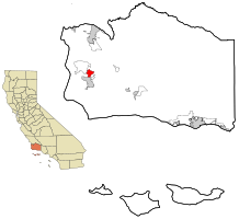
 Location in Santa Barbara County and the state of California | |
| Coordinates: 34°42′23″N 120°27′56″W / 34.70639°N 120.46556°W | |
| Country | |
| State | |
| County | Santa Barbara |
| Government | |
| • State senator | Monique Limón (D)[1] |
| • Assemblymember | Jasmeet Bains (D)[1] |
| • U. S. rep. | Salud Carbajal (D)[2] |
| Area | |
• Total | 5.248 sq mi (13.590 km2) |
| • Land | 5.247 sq mi (13.588 km2) |
| • Water | 0.001 sq mi (0.001 km2) 0.01% |
| Elevation | 374 ft (114 m) |
| Population | |
• Total | 7,308 |
| • Density | 1,400/sq mi (540/km2) |
| Time zone | UTC-8 (PST) |
| • Summer (DST) | UTC-7 (PDT) |
| ZIP code | 93436 |
| Area code | 805 |
| FIPS code | 06-82086 |
| GNIS feature ID | 1867066 |
Vandenberg Village is a census-designated place (CDP) in the unincorporated area of Santa Barbara County, California, United States. The population was 6,497 at the 2010 census, up from 5,802 at the 2000 census.
It is a community situated in the hills north of Lompoc, California. While shops and markets can be found in Vandenberg Village, many residents commute to nearby Lompoc on a daily basis.[5]
It is close to Vandenberg Space Force Base.
- ^ a b "Statewide Database". UC Regents. Retrieved February 2, 2015.
- ^ "California's 24th Congressional District - Representatives & District Map". Civic Impulse, LLC. Retrieved September 29, 2014.
- ^ "2010 Census U.S. Gazetteer Files – Places – California". United States Census Bureau.
- ^ "US Census Bureau". www.census.gov. Retrieved August 18, 2024.
- ^ McCormack, Don (1999). McCormack's Guides Santa Barbara and Ventura 2000. Mccormacks Guides. Page 70. ISBN 9781929365098.