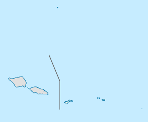
Vatia | |
|---|---|
Village | |
 Vatia from the Tuafanua Trail in the National Park of American Samoa | |
| Etymology: Samoan: "between the tombs of those with paramount status" | |
| Coordinates: 14°15′03″S 170°40′33″W / 14.25083°S 170.67583°W | |
| Country | |
| Territory | |
| Island | Tutuila Island |
| Named for | Samoan mythology[1]: 49 |
| Area | |
| • Land | 2.50 sq mi (6.5 km2) |
| Population (2020) | |
| • Total | 460 |
| • Density | 256.2/sq mi (98.9/km2) |
| Demonym | Vatian |
| Time zone | UTC−11 (Samoa Time Zone) |
| ZIP Code | 96799 |
| Area code | +1 684 |
Vatia is a village on Tutuila Island in American Samoa. It is a north shore village located on Vatia Bay. The road to Vatia, American Samoa Highway 006, is the only road going through National Park of American Samoa.[2] Vatia is a scenic community at the foot of Pola Ridge and surrounded by the national park.[3] It is only reached by Route 6 which traverses the national park before reaching Vatia. There was once a hiking trail over Maugaloa Ridge from Leloaloa, but since the completion of Route 6, this trail is now overgrown.[4] It is home to a beach, and panoramic views of jungle-covered peaks surround the village on all sides. Vatia is the center of the Tutuila-section of National Park of American Samoa.[5] It is located in Vaifanua County.[6][7]
Vatia is home to several concrete bunkers from World War II located on and around the beach. The scenic road between Vatia and Afono is lined with gardens of ornamental plants and flowers. At the end of the road in Vatia is the school, and beyond the school begins a trail leading into the national park. It ends at a rocky cliff which points across Vai'ava Strait to Pola Island. Many Vatians work at the canneries in Pago Pago, and there is good public transportation to and from Pago Pago. Aiga buses from Fagatogo head to Vatia several times per day on weekdays. The village of Vatia can also be visited by hiking Mount ‘Alava.[8]
Vatia is one of the oldest settlements on Tutuila Island and it has historically been regarded as the principal place of eastern Tutuila. Vatia dwells around Vatia Bay which is protected and surrounded by green forested mountains and rich coastal reefs on its seafront.[1]: 48
Vatia Bay has been described as Tutuila Island's most scenic area. A steep ridge curves around the village's west side and leads to Pola Island, which has been claimed to be the most photographed site on Tutuila Island.[9] Pola Island is the most popular attraction in the village.[1]: 59
- ^ a b c Fai'ivae, Alex Godinet (2018). Ole Manuō o Tala Tu’u Ma Fisaga o Tala Ave. Amerika Samoa Humanities Council. ISBN 9781546229070.
- ^ Goodwin, Bill (2006). Frommer’s South Pacific. Wiley. Page 401. ISBN 9780471769804.
- ^ "Homestay - Details". National Park Service. Retrieved 30 November 2021.
- ^ United States National Park Service (1997). National Park of American Samoa, General Management Plan (GP), Islands of Tutulla, Ta'u, and Ofu: Environmental Impact Statement. U.S. National Park Service. Page 21.
- ^ Stanley, David (2004). Moon Handbooks South Pacific. David Stanley. Page 479. ISBN 9781566914116.
- ^ Tu’u’u, Misilugi Tulifau Tofaeono (2002). History of Samoa Islands: Supremacy & Legacy of the Malietoa (na Fa'alogo i Ai Samoa). Tuga'ula Publication. Page 427. ISBN 9780958219914.
- ^ Krämer, Augustin (2000). The Samoa Islands. University of Hawaii Press. Page 424. ISBN 9780824822194.
- ^ Swaney, Deanna (1994). Samoa: Western & American Samoa: a Lonely Planet Travel Survival Kit. Lonely Planet Publications. Page 177. ISBN 9780864422255.
- ^ Hughes, Holly (2010). Frommer’s 500 Extraordinary Islands (500 Places). Frommer’s. Pages 86-87. ISBN 9780470500705
