| Vaud Alps | |
|---|---|
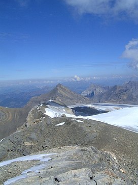
 View from the Sommet des Diablerets to the northeast to the Oldenhorn. | |
| Highest point | |
| Peak | Diablerets |
| Elevation | 3,216 m (10,551 ft) |
| Coordinates | 46°18′14″N 7°11′20″E / 46.30389°N 7.18889°E |
| Naming | |
| Native name | |
| Geography | |
 | |
| Country | Switzerland |
| Cantons | Vaud and Valais |
| Range coordinates | 46°18′N 7°11′E / 46.300°N 7.183°E |
| Parent range | Bernese Alps |
| Topo map | Swiss Federal Office of Topography swisstopo |
The Vaud Alps (German: Waadtländer Alpen, French: Alpes vaudoises, Italian: Alpi di Vaud) are a mountain range of the Western Alps, located in western Switzerland. They are sometimes also referred to as the western Bernese Limestone Alps and as an extension of the Bernese Alps. According to SOIUSA, they are thus the western subsection 12.III according to SOIUSA of the Bernese Alps in the wide meaning.
The highest peak is Le Sommet des Diablerets, 3216 m above sea level. In the alpine guides of the Swiss Alpine Club, they are summarized with the Vaudois pre-Alps.[1]
- ^ Guide des Alpes et Préalpes vaudoises, de Guide Club Alpin Suisse