Veer Savarkar International Airport | |||||||||||
|---|---|---|---|---|---|---|---|---|---|---|---|
 | |||||||||||
| Summary | |||||||||||
| Airport type | Public/Military | ||||||||||
| Operator | Airports Authority of India | ||||||||||
| Serves | Andaman and Nicobar Islands | ||||||||||
| Location | Port Blair, Andaman and Nicobar Islands, India | ||||||||||
| Opened | 20 January 2005 | ||||||||||
| Elevation AMSL | 4 m / 14 ft | ||||||||||
| Coordinates | 11°38′28″N 092°43′47″E / 11.64111°N 92.72972°E | ||||||||||
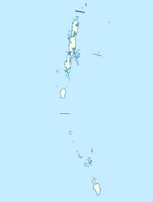
| Map | |||||||||||
 | |||||||||||
| Runways | |||||||||||
| |||||||||||
| Statistics (April 2023 - March 2024) | |||||||||||
| |||||||||||
Veer Savarkar International Airport (IATA: IXZ, ICAO: VOPB) is an airport located 2 km (1.2 mi) south of Port Blair and the primary airport serving the Andaman and Nicobar Islands of India.[4] Earlier known as Port Blair Airport, it was renamed in 2002 after Vinayak Damodar Savarkar, who had been detained in the Cellular Jail in the city for 11 years during India’s freedom struggle.[5] It operates as a civil enclave, sharing airside facilities with INS Utkrosh of the Indian Navy.[6]
- ^ "Annexure III – Passenger Data" (PDF). aai.aero. Retrieved 24 April 2024.
- ^ "Annexure II – Aircraft Movement Data" (PDF). aai.aero. Retrieved 24 April 2024.
- ^ "Annexure IV – Freight Movement Data" (PDF). aai.aero. Retrieved 24 April 2024.
- ^ "Here's what the Veer Savarkar International Airport to be inaugurated by PM Modi looks like". The Indian Express.
- ^ "Lok Sabha Debates - Regarding Renaming Of Port Blair Airport In Andaman After The Name Of Port Blair airport on 8 May, 2002". www.indiankanoon.org. Government of India. Retrieved 17 April 2019.
- ^ "New Terminal Building at Port Blair Airport by March 2018". Press Information Bureau. 22 August 2013. Retrieved 6 January 2014.

