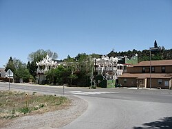
Verdi, Nevada | |
|---|---|
 | |
 Location of Verdi, Nevada | |
| Coordinates: 39°31′6″N 119°59′19″W / 39.51833°N 119.98861°W | |
| Country | United States |
| State | Nevada |
| County | Washoe |
| Area | |
• Total | 3.43 sq mi (8.89 km2) |
| • Land | 3.31 sq mi (8.58 km2) |
| • Water | 0.12 sq mi (0.30 km2) |
| Elevation | 4,899 ft (1,493 m) |
| Population (2020) | |
• Total | 1,396 |
| • Density | 421.24/sq mi (162.63/km2) |
| Time zone | UTC-8 (Pacific (PST)) |
| • Summer (DST) | UTC-7 (PDT) |
| ZIP code | 89439 |
| FIPS code | 32-79400 |
| GNIS feature ID | 0861844[2] |
| Reference no. | 191 |
Verdi (/ˈvɜːrdaɪ/ VUR-dye) is a census-designated place (CDP) in Washoe County, Nevada, United States.[2] It is on the western side of the Reno–Sparks Metropolitan Statistical Area, near Interstate 80 and stretches eastward towards its neighborhood-exclave of Lawton, Nevada surrounded by Reno, Nevada west of Mae Anne Avenue. The CDP of Verdi, California lies immediately adjacent across the state line. Both are in the shadow of California's Verdi Range. In 2010, the population was 1,415.[3] Prior to 2010, the community was listed by the U.S. Census Bureau as part of the Verdi-Mogul CDP.[3]
- ^ "ArcGIS REST Services Directory". United States Census Bureau. Retrieved September 19, 2022.
- ^ a b c U.S. Geological Survey Geographic Names Information System: Verdi, Nevada
- ^ a b "Geographic Identifiers: 2010 Demographic Profile Data (G001): Verdi CDP, Nevada". U.S. Census Bureau, American Factfinder. Archived from the original on February 12, 2020. Retrieved January 17, 2013.