Veyo, Utah | |
|---|---|
 | |
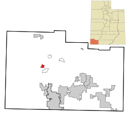
 Location in Washington County and the State of Utah | |
| Coordinates: 37°20′34″N 113°42′12″W / 37.34278°N 113.70333°W | |
| Country | United States |
| State | Utah |
| County | Washington |
| Elevation | 4,472 ft (1,363 m) |
| Population | |
| • Total | 483 |
| Time zone | UTC-7 (Mountain (MST)) |
| • Summer (DST) | UTC-6 (MDT) |
| ZIP code | 84782 |
| Area code | 435 |
| GNIS feature ID | 2629956[1] |
Veyo is a census-designated place in western Washington County, Utah, United States,[1] on the edge of the Dixie National Forest. The population was 483 at the 2010 census. The town lies along State Route 18 north of the city of St. George.[3][4]
- ^ a b c U.S. Geological Survey Geographic Names Information System: Veyo, Utah
- ^ "U.S. Census website". United States Census Bureau. Retrieved May 23, 2011.
- ^ "MyTopo Maps - Veyo, UT, USA" (Map). mytopo.com. Trimble Navigation, Ltd. Retrieved March 18, 2018.
- ^ Rand McNally. The Road Atlas '08. Chicago: Rand McNally, 2008, p. 102.