Vidora | |
|---|---|
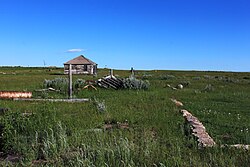
 Main Street Vidora 2010 | |
| Motto: "The Place to Be" (1910s) | |
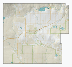
| Coordinates: 49°19′38″N 109°24′30″W / 49.3272°N 109.4084°W | |
| Country | Canada |
| Province | Saskatchewan |
| Region | Southwest |
| Rural municipality | Reno No. 51 |
| Established | 1910 |
| Incorporated (Village) | 1917 |
| Restructured (Unincorporated) | January 1, 1952 |
| Government | |
| • Reeve | Brian McMillan |
| • Administrator | Lacelle Kim |
| • Governing body | Reno No. 51 |
| • MLA | Doug Steele |
| • MP | Jeremy Patzer |
| Population (1920) | |
| • Total | 200 |
| Postal code | S0N 2W0 |
| Area code | 306 |
| Highways | Highway 13 |
| Railways | Great Western Railway |
| [1][2][3][4] | |
Vidora is an unincorporated community within the Rural Municipality of Reno No. 51, Saskatchewan, Canada. The community once had a population of 200 people in 1940 and has since declined to 1 resident. It previously held village status until it was dissolved as an unincorporated community on January 1, 1952. The community is located between Robsart and Consul on Highway 21 and Highway 13, known as the Red Coat Trail. Very little remains of the former village, only one home that is also used as a post office still stands as of 2008. There are many cement foundations and sidewalks still found scattered around the town site, including the remnants of the old bank vault to the former Municipality Office that was moved to Consul.
- ^ National Archives, Archivia Net, Post Offices and Postmasters, archived from the original on 6 October 2006, retrieved 18 January 2008
- ^ Government of Saskatchewan, MRD Home, Municipal Directory System, archived from the original on 21 November 2008
- ^ Canadian Textiles Institute. (2005), CTI Determine your provincial constituency, archived from the original on 11 September 2007
- ^ Commissioner of Canada Elections, Chief Electoral Officer of Canada (2005), Elections Canada On-line

