| Viking Coastal Trail | |
|---|---|
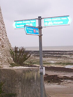
 Marker Viking Coastal Trail at Beresford Gap (National Cycle Network 15) | |
| Length | 25 mi (40 km) |
| Location | Kent |
| Trailheads | St Nicholas at Wade 51°21′15″N 1°15′07″E / 51.3541°N 1.2519°E Reculver Towers 51°19′51″N 1°18′58″E / 51.3309°N 1.3161°E |
| Use | Cycling and Hiking, |
| Highest point | 42 m (135 ft) |
| Months | All year |
The Viking Coastal Trail is a 25-mile multi-user route around the Isle of Thanet, keeping as close as is possible to the coast. It is also Regional Route 15 of the National Cycle Network. From Reculver (going clock-wise), the trail passes through Margate, Broadstairs and Ramsgate to reach Pegwell Bay, where Vikings first landed in Kent. The Trail then, uses an inland route on quiet lanes (except the short section beside the A299), passing through a couple of villages with ancient churches including Minster-in-Thanet Abbey and St Nicholas at Wade, to return to Reculver.