Vila Nova de Cerveira | |
|---|---|
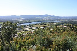
 Portugal-Spain border divided by the Minho River. Taken from Atalaia de Lovelhe. | |
 | |
| Coordinates: 41°58′N 8°41′W / 41.967°N 8.683°W | |
| Country | |
| Region | Norte |
| Intermunic. comm. | Alto Minho |
| District | Viana do Castelo |
| Parishes | 11 |
| Government | |
| • President | Rui Pedro Teixeira Ferreira da Silva (PS) |
| Area | |
• Total | 108.47 km2 (41.88 sq mi) |
| Population (2021) | |
• Total | 8,923 |
| • Density | 82/km2 (210/sq mi) |
| Time zone | UTC+00:00 (WET) |
| • Summer (DST) | UTC+01:00 (WEST) |
| Website | http://www.cm-vncerveira.pt |
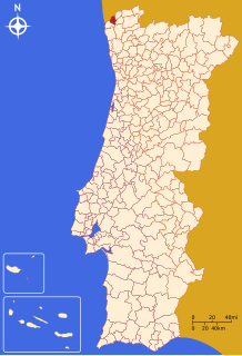
Vila Nova de Cerveira (Portuguese pronunciation: [ˈvilɐ ˈnɔvɐ ðɨ sɨɾˈvɐjɾɐ] ) is a municipality in the district of Viana do Castelo in Portugal. The population in 2021 was 8,923,[1] in an area of 108.47 km2.[2]
The municipal holiday is October 1.

