Vila Real | |
|---|---|
|
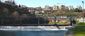
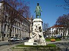
From top left to right: Corgo River near Codessais, Carvalho Araújo Statue, Mateus Palace, St. Peter's Church, Quintela Tower and St. Paul's Church (Capela Nova). | |
 | |
| Coordinates: 41°17′45″N 07°44′46″W / 41.29583°N 7.74611°W | |
| Country | |
| Region | Norte |
| Intermunic. comm. | Douro |
| District | Vila Real |
| Established | 1289 (city: 1925) |
| Government | |
| • President | Rui Santos (PS) |
| Area | |
| • Total | 378.80 km2 (146.26 sq mi) |
| Elevation | 450 m (1,480 ft) |
| Population (2021) | |
| • Total | 49,574 |
| • Density | 130/km2 (340/sq mi) |
| Time zone | UTC±00:00 (WET) |
| • Summer (DST) | UTC+01:00 (WEST) |
| Postal code | 5000 |
| Area code | 259 |
| Website | https://www.cm-vilareal.pt/ |
Vila Real (Portuguese pronunciation: [ˈvilɐ ʁiˈal] ) is the capital and largest city of the Vila Real District, in the North region, Portugal. It is also the seat of the Douro intermunicipal community and of the Trás-os-Montes e Alto Douro historical province. The Vila Real municipality covers an area of 378.80 square kilometres (146.26 sq mi)[1] and is home to an estimated population of 49,574 (2021),[2] of which about 30,000 live in the urban area (2021).[3]
The city is located in a plateau 450 m (1,510 ft) high,[4] over the promontory formed by the gorges of the Corgo and Cabril rivers, where the oldest part of town (Vila Velha) is located, framed by the escarpments of the Corgo gorge. The Alvão and Marão mountains overlook the town on the northwest and southwest side, respectively, rising up to 1,400 m (4,600 ft). With over seven hundred years of existence, the city was once known as the "royal court of Trás-os-Montes" due to the high number of manors bearing coats of arms and family crests, attesting the presence of noble figures that established in the city by influence of the Marquis of Vila Real, the most powerful aristocratic house in Portugal, during the 16th and 17th centuries, after the Dukes of Braganza and the Dukes of Aveiro. Many of these family crests are still visible today in the manors spread throughout the old city and in the Carreira Garden.[5]
Vila Real was ranked seventh in the list of Portugal's most livable cities in the survey of living conditions published by the Portuguese newspaper Expresso in 2007.[6]
- ^ "Áreas das freguesias, concelhos, distritos e país". Archived from the original on 2018-11-05. Retrieved 2018-11-05.
- ^ INE: "Resultados Preliminares Censos 2021 INE". Retrieved 14 february 2022.
- ^ INE (2013). Anuário Estatístico da Região Norte 2012. Lisboa: Instituto Nacional de Estatística. p. 31. ISBN 978-989-25-0218-2. ISSN 0871-911X. Retrieved 2014-03-13.
- ^ "Caraterização". www.cm-vilareal.pt. Retrieved 2020-06-27.
- ^ Câmara Municipal de Vila Real: Concelho: História. Acedido a 04/09/2011.
- ^ Classificação Expresso das melhores cidades portuguesas para viver em 2007, Expresso


