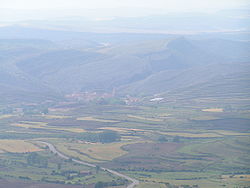
Villarroya de los Pinares, Spain | |
|---|---|
 | |
| Nickname: Villarroya | |
| Coordinates: 40°32′N 0°40′W / 40.533°N 0.667°W | |
| Country | |
| Autonomous community | |
| Province | |
| Region | Maestrazgo |
| Area | |
• Total | 66.41 km2 (25.64 sq mi) |
| Elevation | 1,337 m (4,386 ft) |
| Population (2018)[1] | |
• Total | 160 |
| • Density | 2.4/km2 (6.2/sq mi) |
| Time zone | UTC+1 (CET) |
| Website | http://www.villarroyadelospinares.es |
Villarroya de los Pinares is a municipality located in the Maestrazgo[2] region, province of Teruel, Aragon, Spain. According to the 2004 census (INE), the municipality had a population of 190 inhabitants.
It is in the northern part of the Gúdar mountain range next to the Guadalope River at an altitude of 1,337 meters and at a distance of 51 km from the provincial capital, Teruel on the A-226 road.
- ^ Municipal Register of Spain 2018. National Statistics Institute.
- ^ "Maestrazgo".
