This article needs additional citations for verification. (September 2020) |
Virginia | |
|---|---|
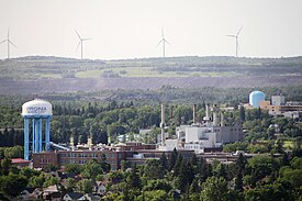
 View of Virginia, showing a water tower and a line of wind turbines in the distance | |
| Nickname: Queen City of the North | |
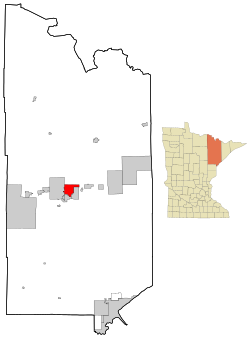
 Location of the city of Virginia within St. Louis County, Minnesota | |
| Coordinates: 47°31′2″N 92°32′29″W / 47.51722°N 92.54139°W | |
| Country | United States |
| State | Minnesota |
| County | St. Louis |
| Established | March 1892 |
| Incorporated | February 1895 |
| Named for | U.S. state of Virginia |
| Government | |
| • Mayor | Larry A. Cuffe Jr.[1] |
| Area | |
| • Total | 19.10 sq mi (49.46 km2) |
| • Land | 18.77 sq mi (48.61 km2) |
| • Water | 0.33 sq mi (0.85 km2) |
| Elevation | 1,440 ft (439 m) |
| Population | |
| • Total | 8,421 |
| • Estimate (2022)[5] | 8,332 |
| • Density | 448.67/sq mi (173.23/km2) |
| Time zone | UTC–6 (Central (CST)) |
| • Summer (DST) | UTC–5 (CDT) |
| ZIP Code | 55741, 55777, 55792 |
| Area code | 218 |
| FIPS code | 27-67288 |
| GNIS feature ID | 0662719[3] |
| Sales tax | 8.375%[6] |
| Website | www.virginiamn.us |
Virginia is a city in St. Louis County, Minnesota, United States, on the Mesabi Iron Range. With an economy heavily reliant on large-scale iron ore mining, Virginia is considered the Mesabi Range's commercial center. The population was 8,423 people at the 2020 census.[4] Virginia is a part of the Duluth metropolitan area,[7] and U.S. Highway 53 runs through town.
- ^ "MN Election Results". electionresults.sos.state.mn.us. Retrieved April 6, 2018.
- ^ "2020 U.S. Gazetteer Files". United States Census Bureau. Retrieved July 24, 2022.
- ^ a b U.S. Geological Survey Geographic Names Information System: Virginia, Minnesota
- ^ a b "Explore Census Data". United States Census Bureau. Retrieved March 12, 2023.
- ^ Cite error: The named reference
USCensusEst2022was invoked but never defined (see the help page). - ^ "Virginia (MN) sales tax rate". Retrieved January 21, 2024.
- ^ "2020 State-based Metropolitan and Micropolitan Statistical Areas Maps". Census.gov. Retrieved December 26, 2021.
