| Vitim | |
|---|---|
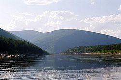
 The Vitim near its tributary Bambuyka | |
 Lena watershed | |
| Native name | |
| Location | |
| Country | Russia |
| Region | Buryatia, Irkutsk Oblast, Sakha Republic, Zabaykalsky Krai |
| Cities | Bodaybo, Vitim, Mama, Russia |
| Physical characteristics | |
| Source | |
| • location | Confluence of rivers Vitimkan and China, Ikat Range, Irkutsk Oblast |
| • elevation | 1,171 m (3,842 ft) |
| Mouth | Lena |
• coordinates | 59°27′47″N 112°36′05″E / 59.4631°N 112.6013°E |
| Length | 1,940 km (1,210 mi) |
| Basin size | 225,000 km2 (87,000 sq mi) |
| Discharge | |
| • average | 1,937 m3/s (68,400 cu ft/s) |
| Basin features | |
| Progression | Lena→ Laptev Sea |
| Tributaries | |
| • left | Tsipa, Muya, Mamakan, Mama |
| • right | Konda, Karenga, Kalakan, Kalar, Bodaybo |
 | |

The Vitim (Russian: Витим; Evenki: Витым, Witym;[1] Yakut: Виитим, Viitim [local pronunciation];[1] Buryat and Mongolian: Витим, Vitim[1]) is a major tributary of the Lena. Its source is east of Lake Baikal, at the confluence of rivers Vitimkan from the west and China from the east. The Vitim flows first south, bends eastwards and then northward in the Vitim Plateau. Then it flows north through the Stanovoy Highlands and the town of Bodaybo. Including river Vitimkan, its western source, it is 1,978 kilometres (1,229 mi) long, and has a drainage basin of 225,000 square kilometres (87,000 sq mi).[2][3][4]
It is navigable from the Lena to Bodaybo. Upstream, tugs can haul barges as far as the Baikal Amur Mainline (BAM), but this is becoming rare.
The Vitim is an excellent place for adventure rafting, but is rarely visited because of its isolation. Baissa, one of the famous localities of fossil insects is situated on the left bank of the Vitim River.
- ^ a b c Cite error: The named reference
KNABwas invoked but never defined (see the help page). - ^ Витим (река в Бурят. АССР), Great Soviet Encyclopedia
- ^ "Река ВИТИМ in the State Water Register of Russia". textual.ru (in Russian).
- ^ "Река ЧИНА in the State Water Register of Russia". textual.ru (in Russian).