Volusia
Maiaca[1] Volusia Landing | |
|---|---|
 Historic oak near the St. Johns River | |
| Nickname: "Town of Many Forts"[1] | |
| Coordinates: 29°10′07″N 081°31′15″W / 29.16861°N 81.52083°W | |
| Country | |
| State | |
| County | Volusia |
| Settled | Before 1558 |
| Area | |
| • Total | 1.8 sq mi (5 km2) |
| Elevation | 16 ft (5 m) |
| Population (2010) Estimated by adding count in all census blocks overlapping area of Volusia[3] | |
| • Total | 596 (estimate) |
| Demonym | Volusian |
| Time zone | UTC-5 (Eastern (EST)) |
| • Summer (DST) | UTC-4 (EDT) |
| ZIP code | 32102 |
| Area code | 352 |
| GNIS feature ID | 306545[4] |

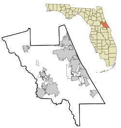
Volusia (/vəˈluːʃə/, və-LOO-shə) is an unincorporated community in Volusia County, Florida, United States, on the eastern shore of the St. Johns River. It is about three miles south of Lake George and across the river from the town of Astor in Lake County. Established by Spanish missionaries, Volusia is one of the oldest European settlements in Florida.[5] The main route through the town is State Road 40, which crosses the St. Johns on the Astor Bridge.
Volusia County takes its name from the community of Volusia, which was named at least as early as 1815. The site of the community was an established indigenous settlement in 1558 when the Mayaca people were first encountered by Spanish explorers. Since then, it has been the site of forts established by the Spanish, British and Americans, in addition to related trading posts. These used the St. Johns River as the major transportation route. During the 1830s, it was the site of conflicts with the Seminole people as the United States government tried to force them to remove to Indian Territory west of the Mississippi River, during Florida's tumultuous beginnings.[1]
- ^ a b c Gibson, Lillian Dillard (1978). Annals of Volusia, 1558-1978: birthplace of Volusia County. Volusia, Florida: R. Alex Gibson.
- ^ Google Earth Polygon Calculation
- ^ "2010 Census Interactive Population Map". US Census Bureau. Archived from the original on October 13, 2013. Retrieved August 24, 2011.
- ^ "US Board on Geographic Names". United States Geological Survey. October 25, 2007. Retrieved January 31, 2008.
- ^ Robinson, Jim (June 8, 1997). "Spanish Missionaries Find Tribes Devoted To Centuries-old Cultures". The Orlando Sentinel.
