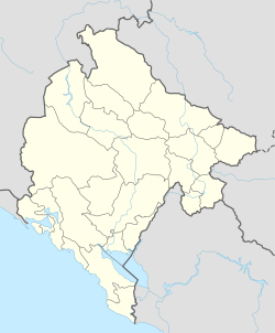
Vranjina | |
|---|---|
Village | |
 Vranjina, view from Žabljak Crnojevića | |
| Coordinates: 42°16′42″N 19°08′05″E / 42.27833°N 19.13472°E | |
| Country | |
| Municipality | |
| Population (2011) | |
| • Total | 209 |
| Time zone | UTC+1 (CET) |
| • Summer (DST) | UTC+2 (CEST) |
Native name: Врањина | |
|---|---|
 | |
 | |
| Geography | |
| Location | Lake Skadar |
| Coordinates | 42°16′26″N 19°08′10″E / 42.274°N 19.136°E |
| Length | 1 km (0.6 mi) |
| Width | 2 km (1.2 mi) |
| Highest elevation | 330 m (1080 ft) |
| Administration | |
| Demographics | |
| Population | 209 (2011) |
Vranjina (Montenegrin: Врањина) is a settlement, island, and a hill in Lake Skadar, in the new Zeta Municipality of Montenegro. Until 2022, it was part of Podgorica Municipality.[1]
Until the first half of the 18th century, Vranjina like other islands of Skadar lake, was one of the hills in the Zeta–Skadar lowlands.[2]
- ^ Obradović, Aleksandra (23 August 2022). "Zeta becomes municipality from today". CdM. Retrieved 6 March 2024.
- ^ Ratko Đurović (1969). Crnom Gorom. "Binoza," Grafički zavod Hrvatske. p. 125. Retrieved 27 July 2013.
Ona predstavljaju uzvišenja u nekadašnjoj Zetsko-skadarskoj površi. Vranjina je, na primjer, postala ostrvo u prvoj polovini XIII vijeka, dok je prije toga bila dio kopna, kao i druga ostrva Skadarskog jezera.
