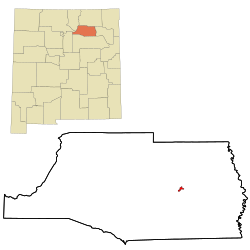
Wagon Mound, New Mexico | |
|---|---|
 Village of Wagon Mound | |
 Location of Wagon Mound, New Mexico | |
| Coordinates: 36°0′26″N 104°42′26″W / 36.00722°N 104.70722°W | |
| Country | United States |
| State | New Mexico |
| County | Mora |
| Area | |
• Total | 1.01 sq mi (2.62 km2) |
| • Land | 1.01 sq mi (2.62 km2) |
| • Water | 0.00 sq mi (0.00 km2) |
| Elevation | 6,201 ft (1,890 m) |
| Population | |
• Total | 266 |
| • Density | 262.85/sq mi (101.52/km2) |
| Time zone | UTC−07:00 (Mountain (MST)) |
| • Summer (DST) | UTC−06:00 (MDT) |
| ZIP Codes | 87735, 87752 |
| Area code | 575 |
| FIPS code | 35-83340 |
| GNIS feature ID | 0915913 |
| Website | sangres |

Wagon Mound is a village in Mora County, New Mexico, United States. It is named after and located at the foot of a butte called Wagon Mound, which was a landmark for covered wagon trains and traders going up and down the Santa Fe Trail and is now Wagon Mound National Historic Landmark. It was previously an isolated ranch that housed four families that served as local traders.[3] The shape of the mound is said to resemble a Conestoga wagon. As of the 2020 census, the village population was 266. It was also called Santa Clara for many years. The village, with brightly painted houses and several stores and shops, is located on the plains of northeastern New Mexico. Interstate 25, which skirts the western side of town, gives a view of the majority of the town. Wagon Mound is not growing rapidly, but it has seen new construction along I-25, with new buildings on the northeast side of town as well.
- ^ "ArcGIS REST Services Directory". United States Census Bureau. Retrieved October 12, 2022.
- ^ Cite error: The named reference
USCensusDecennial2020CenPopScriptOnlywas invoked but never defined (see the help page). - ^ La gente : hispano history and life in Colorado. C. de Baca, Vincent., Colorado Historical Society. Denver, Colo.: Colorado Historical Society. 1998. ISBN 9780870815386. OCLC 40678337.
{{cite book}}: CS1 maint: others (link)
