Wahpeton, North Dakota | |
|---|---|
 Dakota Avenue in downtown Wahpeton, 2007 | |
| Nickname: Home of the Wahpper | |
 Interactive map of Wahpeton | |
| Coordinates: 46°16′19.41″N 96°36′42.97″W / 46.2720583°N 96.6119361°W | |
| Country | United States |
| State | North Dakota |
| County | Richland |
| Settled | 1864 |
| Founded | 1869 |
| Incorporated (town) | 1882 |
| Incorporated (city) | 1887 |
| Government | |
| • Mayor | Brett Lambrecht |
| Area | |
| • City | 5.355 sq mi (13.869 km2) |
| • Land | 5.355 sq mi (13.869 km2) |
| • Water | 0.000 sq mi (0.000 km2) |
| Elevation | 965 ft (294 m) |
| Population | |
| • City | 8,007 |
| • Estimate (2023)[5] | 8,000 |
| • Density | 1,493.91/sq mi (576.81/km2) |
| • Urban | 11,290[2] |
| • Metro | 22,864 (US: 490th) |
| Time zone | UTC–6 (Central (CST)) |
| • Summer (DST) | UTC–5 (CDT) |
| ZIP Codes | 58074, 58075, 58076 |
| Area code | 701 |
| FIPS code | 38-82660 |
| GNIS feature ID | 1036311[3] |
| Highways | ND 13, ND 210 |
| Sales tax | 7.0%[6] |
| Website | wahpeton.com |
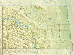
Wahpeton (/ˈwɑːpɪtən/ WAH-pit-ən) is a city in Richland County, in southeast North Dakota along the Bois de Sioux River at its confluence with the Otter Tail River, which forms the Red River of the North. Wahpeton is the county seat of Richland County.[7] The population was 8,007 at the 2020 census.[4]
Wahpeton was founded in 1869 and is the principal city of the Wahpeton Micropolitan Statistical Area, which includes all of Richland County, North Dakota and Wilkin County, Minnesota. Wahpeton's twin city is Breckenridge, Minnesota, on the other side of the river. The Bois de Sioux River and the Otter Tail River join at Wahpeton and Breckenridge to form the Red River of the North.
The North Dakota State College of Science is in Wahpeton. The local newspaper is the Wahpeton Daily News.
- ^ "2024 U.S. Gazetteer Files". United States Census Bureau. Retrieved October 27, 2024.
- ^ United States Census Bureau (October 27, 2024). "2020 Census Qualifying Urban Areas and Final Criteria Clarifications". Federal Register.
- ^ a b U.S. Geological Survey Geographic Names Information System: Wahpeton, North Dakota
- ^ a b "Explore Census Data". United States Census Bureau. Retrieved October 13, 2023.
- ^ Cite error: The named reference
USCensusEst2023was invoked but never defined (see the help page). - ^ "Wahpeton (ND) sales tax rate". Retrieved October 27, 2024.
- ^ "Find a County". National Association of Counties. Retrieved June 7, 2011.


