Waiheke (Māori) | |
|---|---|
 Landsat image of the island, August 2002 | |
 | |
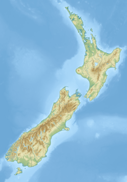
Location in New Zealand & Pacific Ocean | |
| Geography | |
| Location | Hauraki Gulf |
| Coordinates | 36°48′S 175°06′E / 36.800°S 175.100°E |
| Archipelago | New Zealand archipelago |
| Area | 92 km2 (36 sq mi) |
| Length | 19.3 km (11.99 mi) |
| Width | 0.64–9.65 km (0.40–6.00 mi) |
| Coastline | 133.5 km (82.95 mi) |
| Highest elevation | 231 m (758 ft) |
| Highest point | Maunganui |
| Administration | |
New Zealand | |
| Regional Council | Auckland Region |
| Demographics | |
| Demonym | Waihekean |
| Population | 9,140 (June 2024) |
| Pop. density | 99.3/km2 (257.2/sq mi) |
| Ethnic groups | European, Māori |
Waiheke Island (/waɪˈhɛkiː/; Māori: [ˈwaihɛkɛ]) is the second-largest island (after Great Barrier Island) in the Hauraki Gulf of New Zealand. Its ferry terminal in Matiatia Bay at the western end is 21.5 km (13.4 mi) from the central-city terminal in Auckland.
It is the most populated island in the gulf, with 9,140 permanent residents.[1] Another estimated 3,400 have second homes or holiday homes on the island.[2] It is more densely populated than the North and South Islands. It is the most accessible island in the gulf, with regular passenger and car-ferry services, a helicopter operator based on the island, and other air links.[3][better source needed]
In November 2015, Lonely Planet rated Waiheke Island the fifth-best region in the world to visit in 2016.[4]
- ^ "Aotearoa Data Explorer". Statistics New Zealand. Retrieved 26 October 2024.
- ^ "Our research and evaluation resources". Auckland Council. Retrieved 27 June 2023.
- ^ "Waiheke Island information". Tourism Auckland. Retrieved 19 April 2016.
- ^ "Lonely Planet's Best in Travel 2017 list". Lonely Planet. Retrieved 17 October 2017.

