| Waihou River Thames River | |
|---|---|
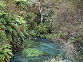
 The Waihou River near Putāruru | |
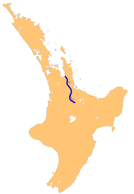
 The Waihou River system | |
| Native name | Waihou (Māori) |
| Location | |
| Country | New Zealand |
| Region | Waikato |
| Physical characteristics | |
| Source | Mamaku Ranges |
| • coordinates | 38°4′34″S 176°1′52″E / 38.07611°S 176.03111°E |
| Mouth | Firth of Thames |
• coordinates | 37°10′5″S 175°32′30″E / 37.16806°S 175.54167°E |
• elevation | Sea level |
| Length | 150 kilometres (93 mi) |
| Basin size | 1,982 square kilometres (765 sq mi) |
| Basin features | |
| Tributaries | |
| • right | Ohinemuri River, Komata River, Hikutaia River, Puriri River |
| Bridges | Kopu Bridge |
The Waihou River is located in the northern North Island of New Zealand. Its former name, Thames River, was bestowed by Captain James Cook in November 1769, when he explored 14 mi (23 km) of the river from the mouth. An older Māori name was "Wai Kahou Rounga". A 1947 Geographic Board enquiry ruled that the official name would be Waihou.[1]
- ^ "Waihou River". New Zealand Gazetteer.