Waitoki | |
|---|---|
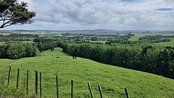
 Farmland near Waitoki in Northern Auckland Region | |
 | |
| Coordinates: 36°38′5″S 174°33′5″E / 36.63472°S 174.55139°E | |
| Country | New Zealand |
| Region | Auckland Region |
| Ward | Rodney ward |
| Community board | Rodney Local Board |
| Subdivision | Kumeū subdivision |
| Electorates | |
| Government | |
| • Territorial Authority | Auckland Council |
Waitoki is a locality in the Rodney District of New Zealand. Wainui is approximately 5.5 kilometres to the north-east, Kaukapakapa 6.5 km to the north-west, and Dairy Flat 10 km to the south-east. The Wainui Stream joins the Waitoki Stream just to the north-east of the locality. The stream flows west into the Kaukapakapa River.[1][2]
- ^ Peter Dowling, ed. (2004). Reed New Zealand Atlas. Reed Books. pp. map 11. ISBN 0-7900-0952-8.
- ^ Roger Smith, GeographX (2005). The Geographic Atlas of New Zealand. Robbie Burton. pp. map 35. ISBN 1-877333-20-4.