Wakefield | |
|---|---|
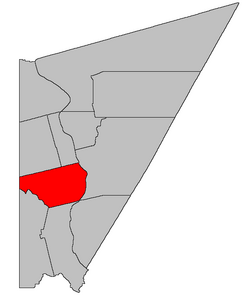
 Location within Carleton County, New Brunswick | |
| Coordinates: 46°13′30″N 67°31′12″W / 46.225°N 67.52°W | |
| Country | |
| Province | |
| County | Carleton |
| Erected | 1803 |
| Area | |
| • Land | 196.31 km2 (75.80 sq mi) |
| Population (2021)[1] | |
• Total | 2,722 |
| • Density | 13.9/km2 (36/sq mi) |
| • Change 2016-2021 | |
| • Dwellings | 1,191 |
| Time zone | UTC-4 (AST) |
| • Summer (DST) | UTC-3 (ADT) |
Wakefield is a geographic parish in Carleton County, New Brunswick, Canada,[2] located north on the west bank of the Saint John River north of Woodstock.
Prior to the 2023 governance reform, for governance purposes it was comprised two local service districts and part of a third, all of which were members of the Western Valley Regional Service Commission (WVRSC).[3]
The Census subdivision of Wakefield Parish shares the geographic parish's borders.[1]

- ^ a b c "Census Profile". Statistics Canada. 26 October 2022. Retrieved 30 October 2022.
- ^ "Chapter T-3 Territorial Division Act". Government of New Brunswick. Retrieved 13 November 2020.
- ^ "Communities in each of the 12 Regional Service Commissions (RSC) / Les communautés dans chacune des 12 Commissions de services régionaux (CSR)" (PDF), Government of New Brunswick, July 2017, retrieved 1 February 2021