| Wakefield | |
|---|---|
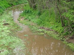
 Wakefield River flowing through Auburn | |
Location of the river mouth in South Australia | |
| Etymology | Edward Gibbon Wakefield[1] |
| Native name | Undalya (Kaurna) |
| Location | |
| Country | Australia |
| State | South Australia |
| Region | Mid North, Adelaide Plains |
| Physical characteristics | |
| Source | Clare Valley |
| • location | Black Springs |
| • coordinates | 33°56′9″S 138°51′46″E / 33.93583°S 138.86278°E |
| • elevation | 429 m (1,407 ft) |
| Mouth | Gulf St Vincent |
• location | Port Wakefield |
• coordinates | 34°11′24″S 138°08′38″E / 34.19000°S 138.14389°E |
• elevation | 0 m (0 ft) |
| Length | 116 km (72 mi) |
| Basin size | 1,913 km2 (739 sq mi) |
| Basin features | |
| Tributaries | |
| • left | Pine Creek (Wakefield River)|Pine Creek, Woolshed Flat Creek |
| • right | Skillogalee Creek |
| [2] | |
The Wakefield River is an ephemeral river that flows to an estuary in the Australian state of South Australia.
- ^ Cite error: The named reference
slsawas invoked but never defined (see the help page). - ^ "Map of Wakefield River, SA". Bonzle Digital Atlas of Australia. Retrieved 25 March 2017.
