Wall, South Dakota
Makȟóšiča Aglágla Otȟuŋwahe | |
|---|---|
 | |
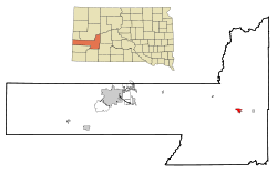
 Location in Pennington County and the state of South Dakota | |
| Coordinates: 43°59′38″N 102°14′42″W / 43.99389°N 102.24500°W | |
| Country | United States |
| State | South Dakota |
| County | Pennington |
| Incorporated | 1908[1] |
| Area | |
• Total | 2.71 sq mi (7.02 km2) |
| • Land | 2.63 sq mi (6.81 km2) |
| • Water | 0.08 sq mi (0.21 km2) |
| Elevation | 2,815 ft (858 m) |
| Population | |
• Total | 699 |
| • Density | 265.78/sq mi (102.62/km2) |
| Time zone | UTC−7 (Mountain (MST)) |
| • Summer (DST) | UTC−6 (MDT) |
| ZIP code | 57790 |
| Area code | 605 |
| FIPS code | 46-68380 |
| GNIS feature ID | 1267622[3] |
| Website | Wall, SD |
Wall (Lakota: Makȟóšiča Aglágla Otȟuŋwahe,[5] "Town alongside the Badlands") is a town in Pennington County, South Dakota, United States. The population was 699 at the 2020 census.[6]
- ^ "SD Towns" (PDF). South Dakota State Historical Society. Retrieved February 17, 2010.
- ^ "ArcGIS REST Services Directory". United States Census Bureau. Retrieved October 15, 2022.
- ^ a b U.S. Geological Survey Geographic Names Information System: Wall, South Dakota
- ^ Cite error: The named reference
USCensusDecennial2020CenPopScriptOnlywas invoked but never defined (see the help page). - ^ Ullrich, Jan F. (2011). New Lakota Dictionary (2nd ed.). Bloomington, IN: Lakota Language Consortium. p. 1140. ISBN 978-0-9761082-9-0.
- ^ "U.S. Census Bureau: Wall town, South Dakota". www.census.gov. United States Census Bureau. Retrieved March 19, 2022.