| Wallsend Newcastle, New South Wales | |||||||||||||||
|---|---|---|---|---|---|---|---|---|---|---|---|---|---|---|---|
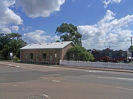
 Railway Goods Shed building (1860s and 1870s). | |||||||||||||||
 | |||||||||||||||
| Coordinates | 32°53′53″S 151°40′05″E / 32.898°S 151.668°E | ||||||||||||||
| Population | 12,470 (2016 census)[1] | ||||||||||||||
| • Density | 1,022/km2 (2,647/sq mi) | ||||||||||||||
| Postcode(s) | 2287 | ||||||||||||||
| Elevation | 9 m (30 ft) | ||||||||||||||
| Area | 12.2 km2 (4.7 sq mi) | ||||||||||||||
| Location |
| ||||||||||||||
| LGA(s) | |||||||||||||||
| Parish | Kahibah | ||||||||||||||
| State electorate(s) | Wallsend | ||||||||||||||
| Federal division(s) | |||||||||||||||
| |||||||||||||||
Wallsend is a western suburb of Newcastle, New South Wales, Australia, 11 kilometres (6.8 mi) from Newcastle's central business district. It is split between the local government areas of City of Newcastle and City of Lake Macquarie.
- ^ Australian Bureau of Statistics (27 June 2017). "Wallsend (State Suburb)". 2016 Census QuickStats. Retrieved 9 February 2018.
