Walnut Islands, California | |
|---|---|
 | |
| Coordinates: 34°3′55″N 117°50′24″W / 34.06528°N 117.84000°W | |
| Country | |
| State | |
| County | |
| Area | |
| • Total | 3.8 sq mi (10 km2) |
| Population (2000) | |
| • Total | 4,053 |
| • Density | 1,122/sq mi (433/km2) |
| Time zone | UTC-8 (PST) |
| • Summer (DST) | UTC-7 (PDT) |
| ZIP code | 91724, 91768, 91789 |
| Area code(s) | 626, 909 |
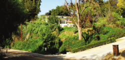
Walnut Islands[1][2][3] or Ramona[4][5] is an unincorporated area[1] in the eastern part of Los Angeles County in the U.S. state of California. The former is the technical term used by the county government,[1] while the latter was used by the Los Angeles Times in 2008[4] and the LA Metro.[5] One news report referred to the area as Covina Hills.[6] Walnut Islands is surrounded by the cities of Covina and San Dimas to the north, Walnut to the south, West Covina to the west, and Pomona to the east.[4] The population of Ramona was 4,053 according to the 2000 census.[4]
- ^ a b c "ESGV_WalnutIslands_ComProfile_20190430.pdf" (PDF). Los Angeles County Department of Regional Planning. April 30, 2019. Archived from the original (PDF) on April 10, 2023. Retrieved June 21, 2022.
- ^ "Community Spotlight: Charter Oak – East San Gabriel Valley Area Plan". planning.lacounty.gov. Retrieved April 7, 2023.
- ^ "Walnut". SGVCityWatch.com. Retrieved April 18, 2023.
Firefighters were called just before 9 a.m. to the 19800 block of Florencita Drive December 12 in an unincorporated area identified as Walnut Islands.
- ^ a b c d "Ramona". Mapping L.A. Retrieved April 7, 2023.
- ^ a b "San Gabriel Valley". LA Metro. Retrieved April 7, 2023.
- ^ 4 injured in brawl at Covina Hills cemetery, retrieved June 22, 2022

