| Walpeup Victoria | |||||||||||||||
|---|---|---|---|---|---|---|---|---|---|---|---|---|---|---|---|
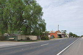
 The Mallee Highway at Walpeup | |||||||||||||||
| Coordinates | 35°08′10″S 142°01′30″E / 35.13611°S 142.02500°E | ||||||||||||||
| Population | 158 (2016 census)[1] | ||||||||||||||
| Postcode(s) | 3507 | ||||||||||||||
| Elevation | 69 m (226 ft) | ||||||||||||||
| Location | |||||||||||||||
| LGA(s) | Rural City of Mildura | ||||||||||||||
| State electorate(s) | Mildura | ||||||||||||||
| Federal division(s) | Mallee | ||||||||||||||
| |||||||||||||||
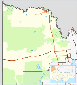
Walpeup /wɔːlpiːˈʌp/ is a town in the Mallee region of north west Victoria. The town is in the Rural City of Mildura local government area and on the Mallee Highway and Pinnaroo railway line between Ouyen and the South Australian border, 458 kilometres (285 mi) north west of the state capital, Melbourne and 130 kilometres (81 mi) south west of the regional centre of Mildura. At the 2016 census, Walpeup had a population of 158.[1]
- ^ a b Australian Bureau of Statistics (27 June 2017). "Walpeup (State Suburb)". 2016 Census QuickStats. Retrieved 1 October 2007.
