Warner, New Hampshire | |
|---|---|
 Statue of Walter Harriman in the town center | |
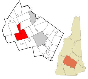
 Location in Merrimack County and the state of New Hampshire. | |
| Coordinates: 43°16′49″N 71°48′57″W / 43.28028°N 71.81583°W | |
| Country | United States |
| State | New Hampshire |
| County | Merrimack |
| Incorporated | 1774 |
| Villages | |
| Government | |
| • Select Board |
|
| • Town Administrator | Kathy Frenette |
| Area | |
| • Total | 55.48 sq mi (143.69 km2) |
| • Land | 55.23 sq mi (143.04 km2) |
| • Water | 0.25 sq mi (0.64 km2) 0.45% |
| Elevation | 446 ft (136 m) |
| Population (2020)[2] | |
| • Total | 2,937 |
| • Density | 53/sq mi (20.5/km2) |
| Time zone | UTC-5 (Eastern) |
| • Summer (DST) | UTC-4 (Eastern) |
| ZIP codes | 03278 (Warner) 03221 (Bradford) |
| Area code | 603 |
| FIPS code | 33-78580 |
| GNIS feature ID | 0873745 |
| Website | www |
Warner is a town in Merrimack County, New Hampshire, United States. The population was 2,937 at the 2020 census.[2] The town is home to Magdalen College of the Liberal Arts, Rollins State Park and Mount Kearsarge State Forest.
The town's central village, where 453 people resided at the 2020 census, is defined as the Warner census-designated place (CDP) and is located along New Hampshire Route 103 and the Warner River. The town also includes the communities of Davisville, Lower Village, Melvin Mills, and Waterloo.
- ^ "2021 U.S. Gazetteer Files – New Hampshire". United States Census Bureau. Retrieved December 16, 2021.
- ^ a b "Warner town, Merrimack County, New Hampshire: 2020 DEC Redistricting Data (PL 94-171)". U.S. Census Bureau. Retrieved December 16, 2021.
