Warroad | |
|---|---|
City | |
 Warroad City Hall | |
| Nickname(s): Hockeytown, USA[1] | |
 | |
| Coordinates: 48°54′19″N 95°18′52″W / 48.90528°N 95.31444°W | |
| Country | United States |
| State | Minnesota |
| County | Roseau |
| Area | |
• Total | 3.38 sq mi (8.76 km2) |
| • Land | 3.27 sq mi (8.48 km2) |
| • Water | 0.11 sq mi (0.29 km2) |
| Elevation | 1,066 ft (325 m) |
| Population (2020) | |
• Total | 1,830 |
| • Density | 559.12/sq mi (215.87/km2) |
| Time zone | UTC-6 (Central (CST)) |
| • Summer (DST) | UTC-5 (CDT) |
| ZIP code | 56763 |
| Area code | 218 |
| FIPS code | 27-68224[4] |
| GNIS feature ID | 0653790[3] |
| Website | warroadmn |
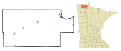
Warroad is a city in Roseau County, Minnesota, United States, at the southwest corner of Lake of the Woods, 7.5 miles (12.1 km) south of Canada. The population was 1,781 at the 2010 census.[5] Warroad had its own newspaper[6] before it was incorporated in 1901.[7]
Minnesota State Highways 11 and 313 are two of the city's main routes.
- ^ "Oshie latest success story from tiny Minn. town". Associated Press. February 15, 2014. Archived from the original on March 15, 2014.
- ^ "2020 U.S. Gazetteer Files". United States Census Bureau. Retrieved July 24, 2022.
- ^ a b "US Board on Geographic Names". United States Geological Survey. October 25, 2007. Retrieved January 31, 2008.
- ^ "U.S. Census website". United States Census Bureau. Retrieved January 31, 2008.
- ^ "2010 Census Redistricting Data (Public Law 94-171) Summary File". American FactFinder. U.S. Census Bureau, 2010 Census. Retrieved April 23, 2011.[dead link]
- ^ Cite error: The named reference
nztwas invoked but never defined (see the help page). - ^ Upham, Warren (1920). Minnesota Geographic Names: Their Origin and Historic Significance. Minnesota Historical Society. p. 475.