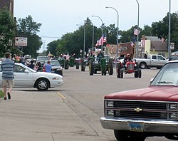
Washburn, North Dakota | |
|---|---|
 2007 Tractor Trek traveling down Main Ave. in Washburn | |
| Motto(s): "The Grandest Little City on the Missouri-Washburn, North Dakota" | |
 | |
| Coordinates: 47°17′31″N 101°01′40″W / 47.29194°N 101.02778°W | |
| Country | United States |
| State | North Dakota |
| County | McLean |
| Founded | 1882 |
| Government | |
| • Commission President | Larry Thomas |
| Area | |
| • Total | 1.79 sq mi (4.63 km2) |
| • Land | 1.69 sq mi (4.36 km2) |
| • Water | 0.10 sq mi (0.27 km2) |
| Elevation | 1,831 ft (558 m) |
| Population | |
| • Total | 1,300 |
| • Estimate (2022)[4] | 1,289 |
| • Density | 771.51/sq mi (297.96/km2) |
| Time zone | UTC-6 (Central (CST)) |
| • Summer (DST) | UTC-5 (CDT) |
| ZIP code | 58577 |
| Area code | 701 |
| FIPS code | 38-83700 |
| GNIS feature ID | 1036316[2] |
| Highways | US 83, US 83 Bus., ND 200 Alt. |
| Website | washburnnd.com |
Washburn is a city in southern McLean County, North Dakota, United States. Located along the upper Missouri River, it is the county seat of McLean County.[5] The population was 1,300 at the 2020 census.[3]
Washburn was founded in 1882 near the former site of Fort Mandan, winter quarters of the Lewis and Clark Expedition in 1804–1805, near a Mandan village. The town was designated as the county seat in 1883. The city's name honors General Cadwallader C. Washburn.[6]
Washburn is home to the North Dakota Lewis and Clark Interpretive Center, which focuses on the Expedition's winter near the Mandan village. It houses a full-scale replica of Fort Mandan, which workers of the expedition built as their base, and one of the expedition's canoes.
- ^ "ArcGIS REST Services Directory". United States Census Bureau. Retrieved September 20, 2022.
- ^ a b U.S. Geological Survey Geographic Names Information System: Washburn, North Dakota
- ^ a b "Explore Census Data". United States Census Bureau. Retrieved October 22, 2023.
- ^ Cite error: The named reference
USCensusEst2022was invoked but never defined (see the help page). - ^ "Find a County". National Association of Counties. Retrieved June 7, 2011.
- ^ "Our Rich History". City of Washburn, North Dakota. Retrieved June 26, 2017.