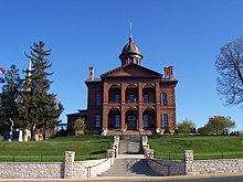
Washington County | |
|---|---|
 | |
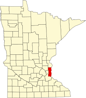
 Location within the U.S. state of Minnesota | |
 Minnesota's location within the U.S. | |
| Coordinates: 45°02′N 92°53′W / 45.04°N 92.89°W | |
| Country | |
| State | |
| Founded | October 27, 1849[1] |
| Named for | George Washington |
| Seat | Stillwater |
| Largest city | Woodbury |
| Area | |
• Total | 423 sq mi (1,100 km2) |
| • Land | 384 sq mi (990 km2) |
| • Water | 38 sq mi (100 km2) 9.1% |
| Population (2020) | |
• Total | 267,568 |
• Estimate (2023) | 278,936 |
| • Density | 630/sq mi (240/km2) |
| Time zone | UTC−6 (Central) |
| • Summer (DST) | UTC−5 (CDT) |
| Congressional districts | 2nd, 4th, 6th |
| Website | www |
Washington County is a county in the U.S. state of Minnesota. As of the 2020 census, the population was 267,568,[2] making it the fifth-most populous county in Minnesota. Its county seat is Stillwater.[3] The largest city in the county is Woodbury, the eighth-largest city in Minnesota and the fourth-largest Twin Cities suburb. Washington County is included in the Minneapolis-St. Paul-Bloomington, MN-WI Metropolitan Statistical Area.

- ^ "Minnesota Place Names". Minnesota Historical Society. Retrieved March 19, 2014.
- ^ "State & County QuickFacts". United States Census Bureau. Retrieved April 10, 2023.
- ^ "Find a County". National Association of Counties. Retrieved June 7, 2011.