 | ||||
| Route information | ||||
| Auxiliary route of I-5 | ||||
| Maintained by WSDOT | ||||
| Length | 13.10 mi[1] (21.08 km) | |||
| Existed | 1964[2]–present | |||
| Major junctions | ||||
| West end | ||||
| East end | ||||
| Location | ||||
| Country | United States | |||
| State | Washington | |||
| Counties | Thurston | |||
| Highway system | ||||
| ||||
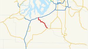
State Route 510 (SR 510) is a state highway in Thurston County, Washington. The 13 miles (20.9 km) long highway extends southeast from an interchange with Interstate 5 (I-5) in Lacey to SR 507 in Yelm. SR 510 roughly parallels the Nisqually River, the border between Thurston and Pierce counties, between the Fort Lewis and Nisqually Indian Community area to Yelm.
The roadway was built by 1916 as a connector from Saint Clair Lake to the Northern Pacific Railway station in Yelm and was designated as Secondary State Highway 5I (SSH 5I) in 1937. The original route of SSH 5I ran from Tumwater east to Yelm, following the present-day Yelm Highway. In 1959, the highway was realigned to serve a new freeway, later I-5, in Lacey; SSH 5I was replaced in the 1964 highway renumbering by SR 510. The Yelm-Tenino Trail was built over the Northern Pacific line in 1993 and a bypass is being constructed around Yelm.
- ^ Multimodal Planning Division (March 1, 2016). State Highway Log Planning Report 2015, SR 2 to SR 971 (PDF) (Report). Washington State Department of Transportation. pp. 1480–1486. Retrieved August 19, 2016.
- ^ Washington State Legislature. "RCW 47.17.685: State route No. 510". Retrieved November 11, 2009.
